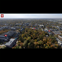
Crescent Aerial Tour
Description
In an effort to improve linking all Iu3D scan data together, the team create a prototype of an aerial tour over Dunn Woods. The tour link to some of IU3D's Matterport and Navis scans along with Sketchfab models. The prototype was motivating, but IU3D opted for higher end solutions such as the ESRI Map available in the IU3D Hub.
Client
IU3D Internal Exploration Project
Services
Photogrammetry
LiDAR
Matterport
360 Imaging
LiDAR
Matterport
360 Imaging
Start Date
Oct 2022
End Date
Mar 2023
